
Another view of Roseberry Topping, this time from Pinchinthorp on the Great Ayton to Guisborough Road. Pinchinthorp is an ancient township, the name deriving from Pincium, or Pinchun, a Norman family who held land here in the 12th century. To describe Pinchinthorp today as a hamlet is a bit of an overstatement.
Category: Roseberry Topping
Roseberry Art

A really good piece of work by Rachel Lonsdale, simple but effective. But I’m not convinced Roseberry needs it. I fear another step towards turning the National Park into a theme park. The idea is to discourage graffitists but with the artwork only on one side, there are three other blank canvasses. It is only a matter of time. Ste and Sarah have already left their mark.
Sunday afternoon on Roseberry
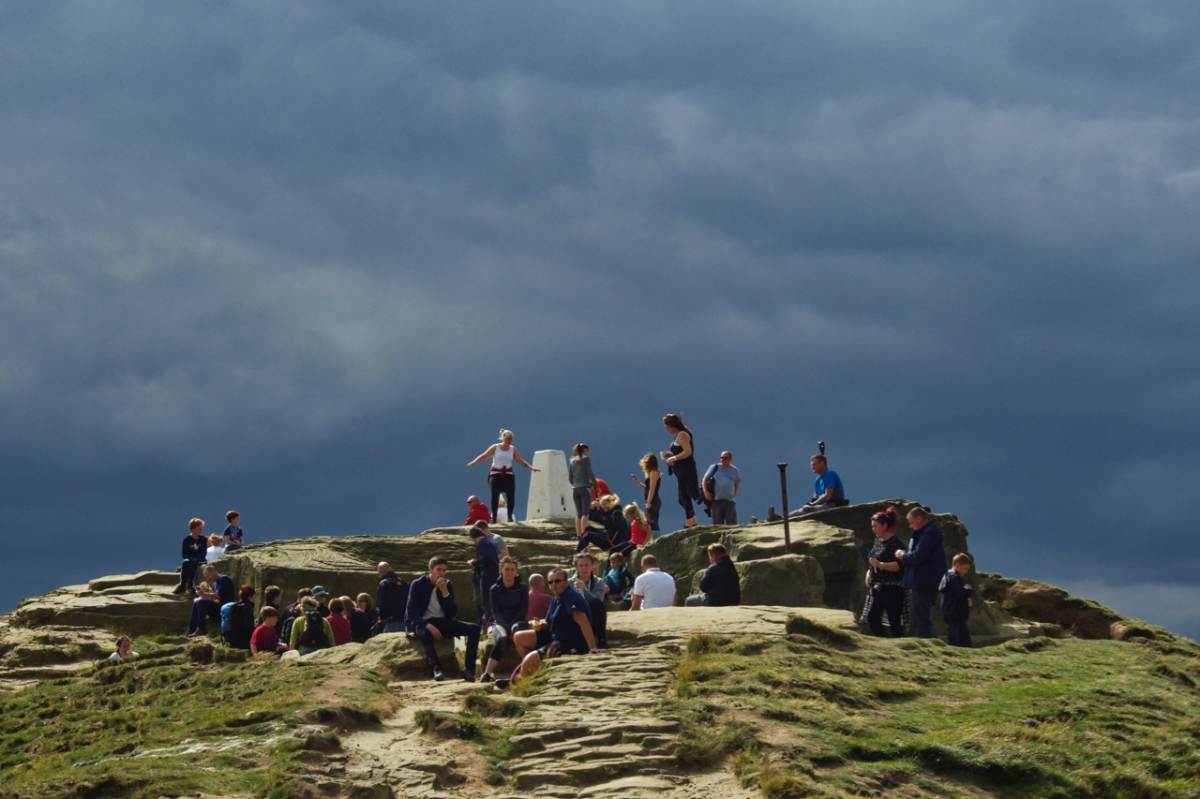
Roseberry summit, Sunday afternoon, a honeypot for the crowds, in spite of the threat of rain. Attracted by the prospect of tea and cakes provided by the National Trust.
Tick magnets
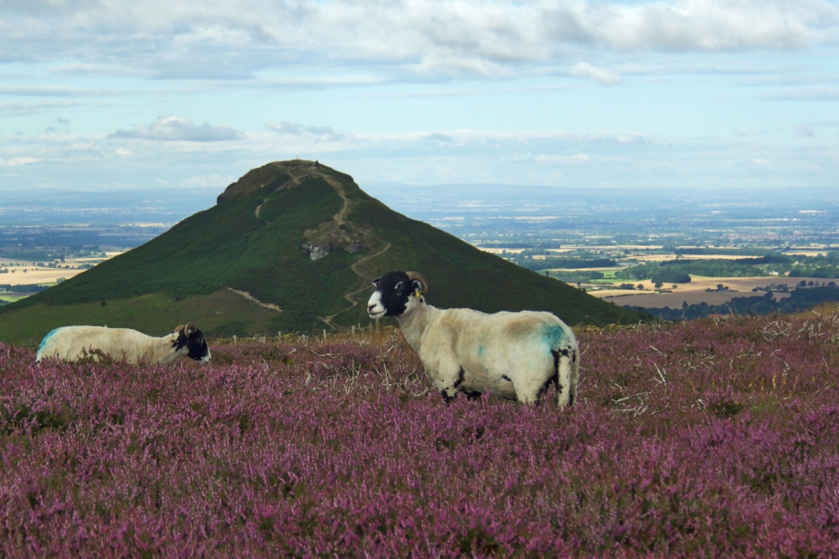
There seems to be less sheep on the moors nowadays. Not sure if this is a deliberate policy. Certainly, in other upland areas, there are concerns about over grazing. At one-time moorland farmers were actively encouraged to graze their sheep on the moors by gamekeepers. The sheep would act as magnets for ticks which also infected grouse chicks causing the transmission of a viral disease by the name of Louping Ill Virus. This could devastate the grouse population. Regular dipping would clear the sheep of ticks. Now with hardly any dipping being done, the tick population is once again soaring, however vaccination of sheep to control ticks has been shown to reduce the incidence of louping ill in red grouse.
The photo was taken on Newton Moor, a small area of heather moorland which is part of the National Trust’s Roseberry Topping property.

It’s turned out nice …
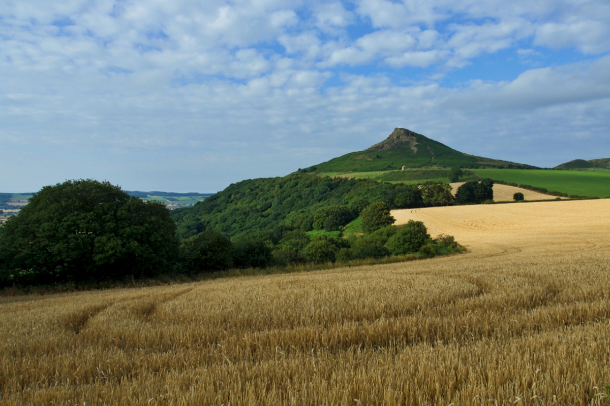
… after a damp start to the morning. The wheat crop in Little Nanny and Great Nanny fields must be due for harvesting soon. And Roseberry Topping, so familiar, looks even grander after a few days away. The nearer southern face of Roseberry, ten acres in total, was donated by Lady Fry to the National Trust in 1997. The northern half had already been under the ownership of the Trust since 1984. Interestingly the summerhouse and its field are not part of the Trust property but is in private ownership and tenanted to Aireyholme Farm.
Roseberry Trig Point
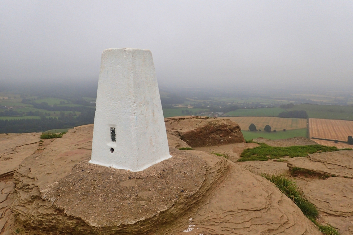
The elusive trig point fairy has been and given Roseberry’s pillar a lick of paint. A fresh clean canvas for the graffiti artists. I happen to know the fairy goes by the name of Ray (no aspersion intended) and he lives in Great Ayton, the village just visible through the low cloud.
Roseberry’s Folly
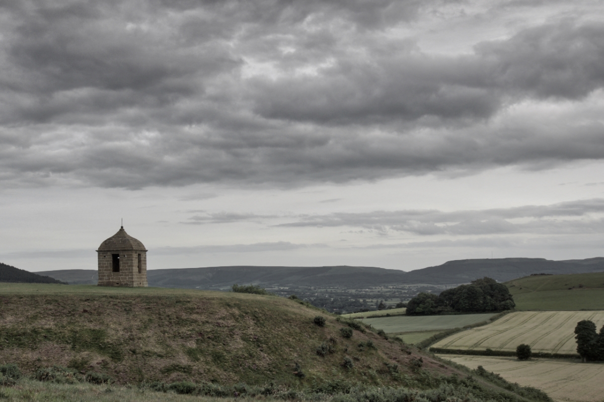
Under threatening evenings skies Roseberry’s folly stands in a prominent position on an ironstone bedrock. A summer or prospect house, built sometime in the late 18th century. The fashion to “enhance the landscape” was prevalent at the time, although modest by Capability Brown’s designs, they may have had an influence. Another summerhouse is marked on old O.S. maps on Faceby Bank but that has long since disappeared. During the Napoleonic Wars it is thought the summerhouse was commandeered by the militia manning the beacon that would have been lit on Roseberry in the event of an invasion.

Roseberry Summit
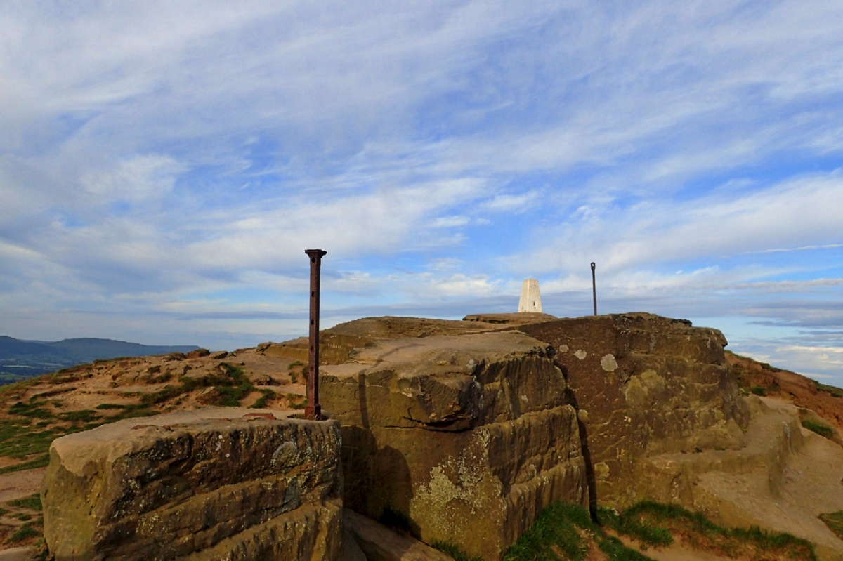
At 320m high Roseberry’s cap of Saltwick Sandstone Formation has been quarried, subjected to intense heat and generally exploited over the centuries. The hill was to have been used as a beacon during the war with Spain in the 1580s and again during the Napoleonic Wars. These beacons were never lit in earnest but in 1902 an enormous beacon was lit to celebrate the coronation of King Edward VII. 32 tons of wood was hauled up using a steam engine. The iron stanchion to the right of the trig point was erected to tie the structure down. Some heat must have been generated. The nearer post is a fence post. At one time the Topping had so many visitors trying to stand on the summit a length of railings were erected along the crag edge. That was before the collapse of 1912 when the railings were dragged down with the rock.

Jurassic Sandstone
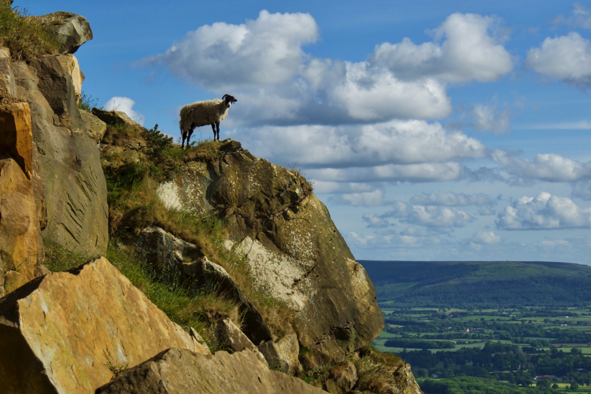
A sheep finds scant grazing amongst the sandstone boulders below Roseberry Topping. Sandstone which, according to geologists, were laid down at the bottom of a tropical sea 180 million years ago.
Bluebell Meadows, Newton Woods
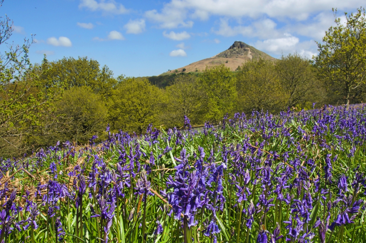
My annual sally into the bluebells in Newton Wood. Maybe still a little early but my patience has run out. An iconic shot, found by just following the paths created by other photographers.
The Bluebell is the sweetest flower
That waves in summer air:
Its blossoms have the mightiest power
To soothe my spirit’s care.
Emily Bronte 1840

You must be logged in to post a comment.