
Harvesting at Aireyholme Farm. Wheat I think. The skyline is the escarpment to Great Ayton with Gribdale Gate to the right.

Harvesting at Aireyholme Farm. Wheat I think. The skyline is the escarpment to Great Ayton with Gribdale Gate to the right.
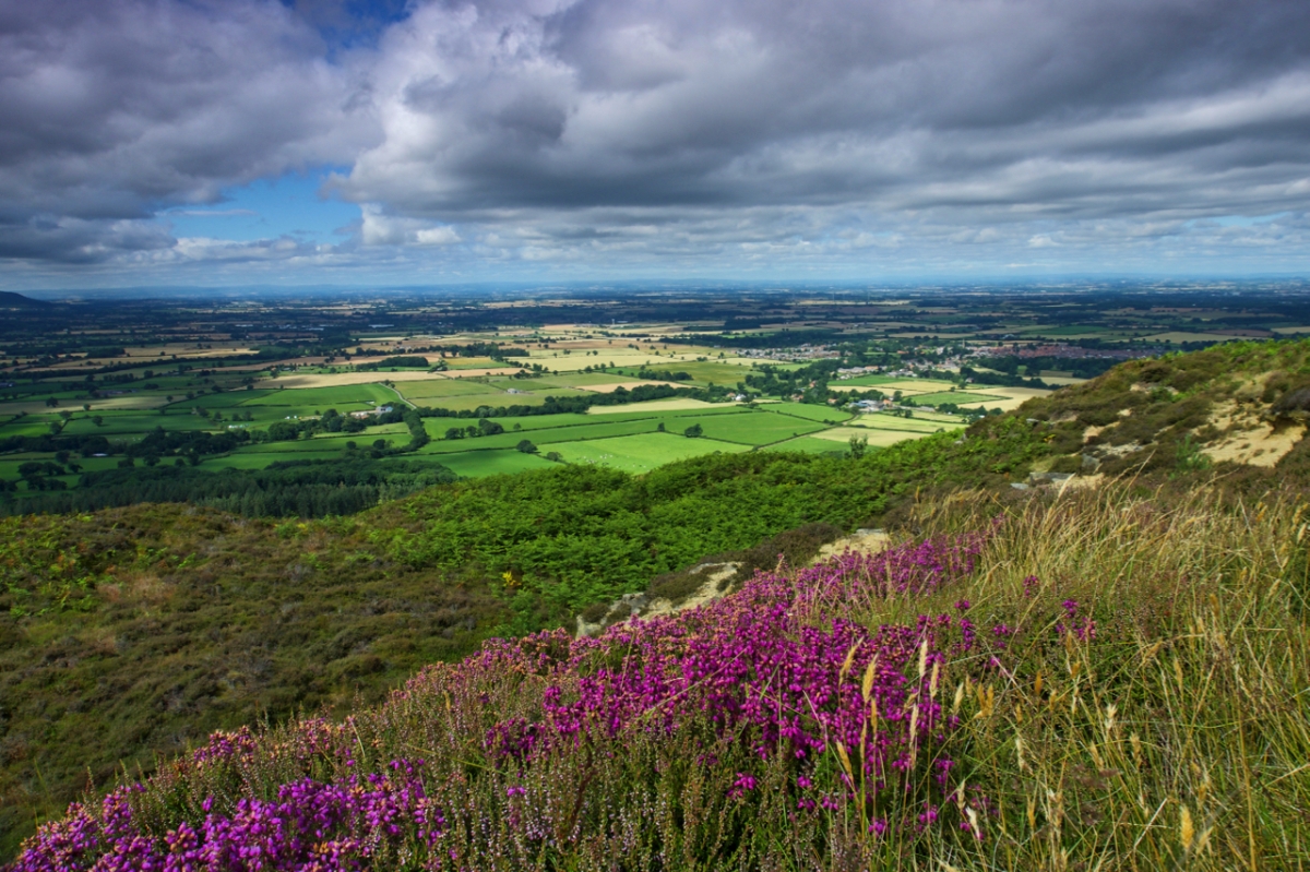
A break in the clouds. The bell heather is passed its best. The ling is beginning to bloom. It’s going to be a fine day. A view from Easby Bank.
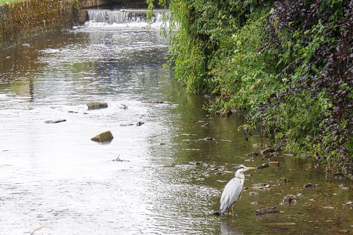
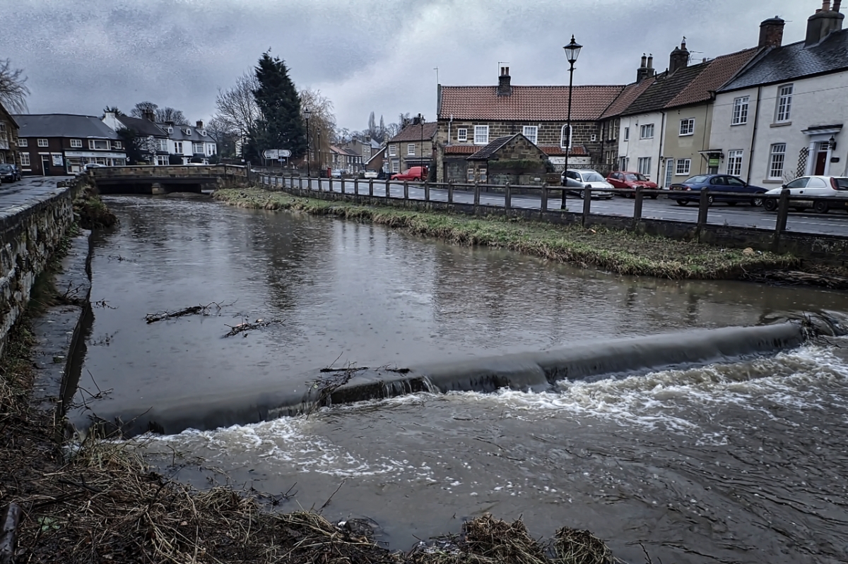
I’d planned a trot over to Brian’s Pond on Carlton Moor having thought raindrops on the water might make a good photo. I wish. Foiled by raindrops on the lens. But driving through Great Ayton the neighbourhood heron came to the rescue, patrolling the River Leven below Suggitt’s Bridge. This was the last photo I managed to get before it took flight and glided twenty metres up the river where it was promptly mobbed by a paddling of ducks. I suppose a small duckling would make a fine morsel for it.

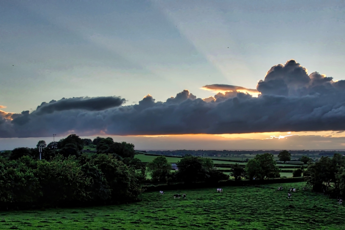
The fourth damp and misty morning in a row. So when the skies clear …
Dingledow is the name given on the Ordnance Survey 1856 map to these fields to the north of Great Ayton. Keeping alive a lost name.
Francis Grose wrote in 1773 :
BETWEEN the towns of Aten and Newton, near the foot of Rosberrye Toppinge, there is a well dedicated to St. Oswald. The neighbours have an opinion, that a shirt, or shift, taken off a sick person, and thrown into that well, will shew whether the person will recover, or die: for if it floated, it denoted the recovery of the party; if it sunk, there remained no hope of their life: and, to reward the Saint for his intelligence, they tear off a rag of the shirt, and leave it hanging on the briars thereabouts; ‘where,’ says the writer, ‘I have seen such numbers, as might have ‘made a fayre rheme in a paper myll.’
Grose, and later Rev. George Young in his “History of Whitby” (1817), are describing a custom that is still seen in Scotland where they are known as “Clootie Wells“.
From the description I reckon St. Oswald’s well to be in the wood on the bottom left of the photo. Chapel Well is shown on the 1856 map. Today there is no hint of any water, just a depression. Of course in the intervening centuries the wood has been bisected by the railway and extensive whinstone quarrying had taken place on Cliff Rigg. These would have affected the hydrology.

In the cool of the evening the last of the evening light strikes the disused sandstone quarry at Cockshaw Hill above Gribdale. Stone from the quarry would have been used for the alum works and Ayton Bank Ironstone Mine. The quarry was certainly in use in the 1920s when its stone was used in the construction of the Temple Moore designed St. Mary’s Church at Nunthorpe.

Also known as Slack’s Gill and until recently buried inside the commercial forestry of Black Bank. It’s my ‘secret’ way up onto Great Ayton Moor. Mine and the mountain bikers who created a downhill course through the wood. But the clear felling has put paid to their activities. I am sure the sandstone crags have been quarried but there is no evidence of the route the stones would have been hauled down the slope. The large boulder in the gill does have an anchor bolt on the top but I guess that could be modern, placed as a protection for rock climbers. I’ve rendered the photo into black and white as the carnage left by the clear felling is hidden.

An unremarkable sandstone wall at the entrance to Firbeck House on Easby Lane in Great Ayton. The ashlar blocks have been dressed well and the wall has been neatly enhanced by the coping stones. On the third course you will notice is a small square hole out of which is growing a stem of ivy. The hole was cut by Mr. Robert Pickersgill who was a member of the village’s Local Defence Volunteers during World War 2. The intention was to provide a spy hole to view the approach to the village from the direction of Easby Lane and if necessary to provide a rifle embrasure.
Right, Pike, you get behind that wall and keep watch. And if any German Panzers come down Easby Lane, hold them at bay.
And don’t tell them your name.
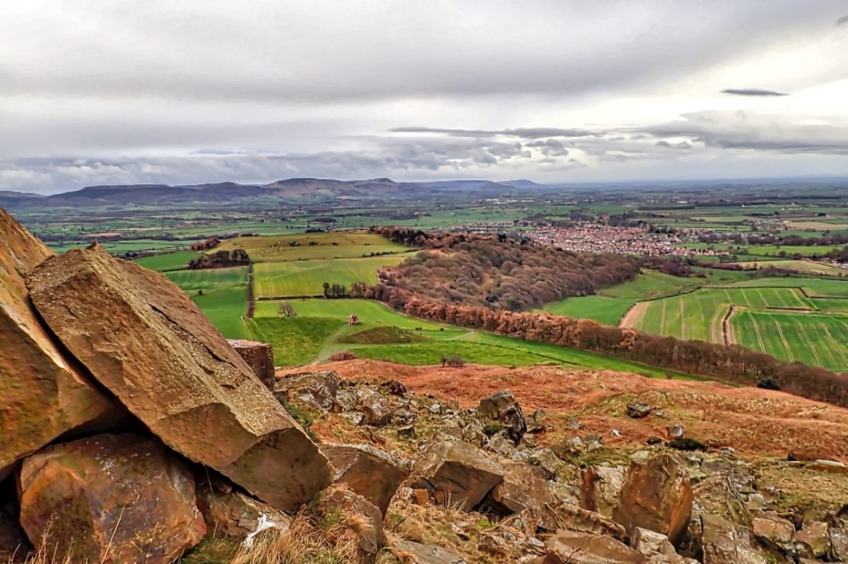
Boulders of Oolite sandstone litter the south west slope of Roseberry, the result of a monumental landslip in 1912. It was said at the time the ironstone miners were to blame but the geologists tell us now that was not so. It would have happened anyway, and it is still happening. The softer mudstone shales are still being eroded weakening the foundations of the crag. A new rockfall will occur. It might be a thousand years but it will occur.
Down below the oakwoods of Newton Wood adorn the escarpment of another sandstone layer, of a much poorer quality to be useful for building stone and in the distance, on the Cleveland Plain, the village of Great Ayton wakes up on this Monday morning.

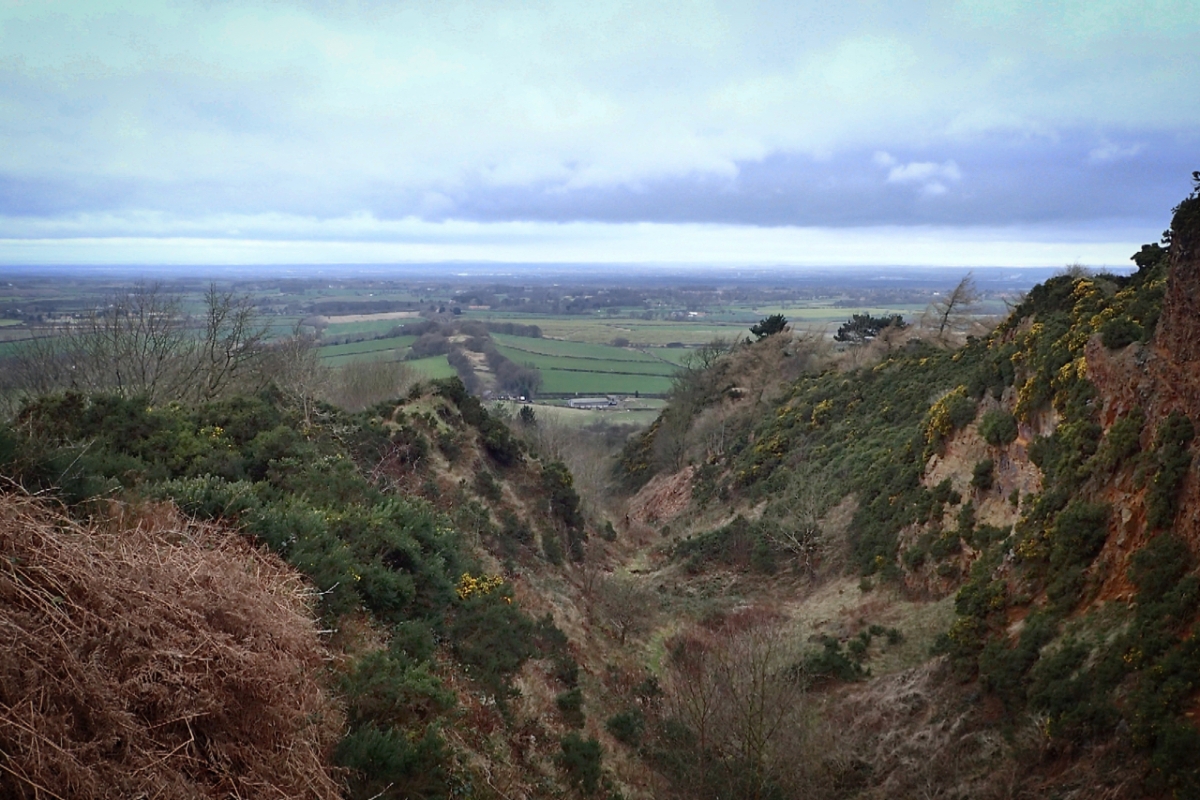
57 million years ago Europe, North America and Asia were locked together in a great continent called Laurasis. Volcanic activity near what is now the Island of Mull in Scotland cause injections of magma deep underground in what geologists call the Mull Dyke Swarm. The magma cooled and formed a vertical dyke of hard igneous rock known as Whinstone. One such dyke outcrops in Cleveland where it is known as the Cleveland Dyke and on Cliff Ridge whinstone has been extensively quarried for use in road building. It is said that the streets of Leeds are cobbled with Great Ayton stone. In the 1880s Percy Winn took over the quarry from Leeds Corporation and is still referred to locally as Winn’s Quarry.
The photo shows the line of the dyke along Langbaurgh ridge heading towards Mull. Beyond Nunthorpe it goes underground but outcrops again at Preston Park on the north bank of the Tees and Cockfield Fell near Hamsterley. The word whin originates from the Old Scandinavian word for gorse, the prickly yellow flowered scrub which flourishes on the sides of the quarry.
The prospect of a day indoors route planning with my Duke of Edinburgh students but managed to get up Roseberry before dawn. Otherwise incessant rain all day. Even the ducks were avoiding a swollen River Leven.


You must be logged in to post a comment.