Giant wormholes, Coney Warren

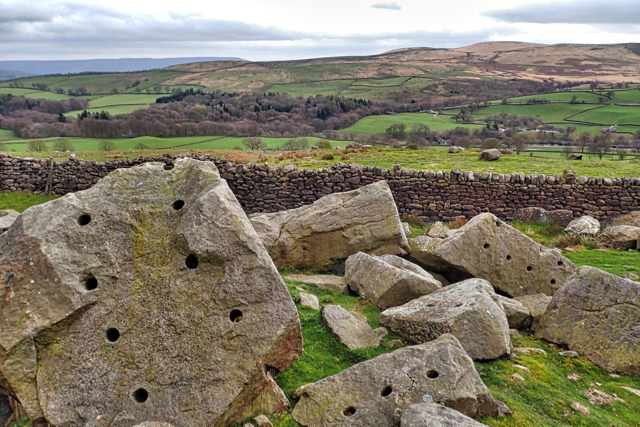
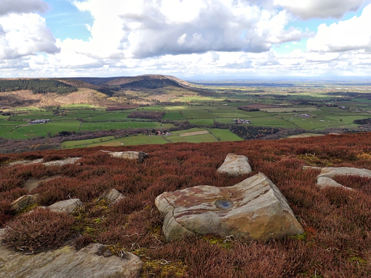
Descending off Barden Fell in Wharfedale I came across these holes in the gritstone boulders. I thought at first they were at attempt at splitting the stone but at about 2” diameter they’re too big surely. There would be no need to be that wide. And some go all the way through the rock. Anyone have any ideas? The area is named Coney Warren so maybe the baby rabbit burrows.

Barden Fell is part of the Bolton Abbey Estate who, according to their information boards, purport to have encouraged public access since the early 19th century yet there are no Public Rights of Way across it. In 1968 the Barden Moor and Barden Fell Access agreement was created, a precursor of the Countryside Rights of Way Act. Apparently the BMBFA sits outside the CROW legislation until 2018 but the rights for Joe Public seem no different to me. No doubt the BMBFA has some benefit for the Estate. Anyway the Estate have created a Permissive Footpath across Barden Fell following an existing landrover track but as dogs are  expressly not permitted I don’t see actually what extra privilege they are giving to the public. So Barden Fell will remain out of bounds for bikes, horses and dogs on a lead or otherwise.

coney warren

Cow and Calf

Millstone grit, a layer of hard sandstone stretching from Edale to Richmond; laid down 320 million years ago when half of Yorkshire was covered by a vast river delta. The millstone grit lies on top of softer layers of shale and on the moor edges, such as here on Ilkley Moor, the shales erode away causing the gritstone to fracture along vertical joints. Gigantic blocks may break off, like the Calf, and slide down the hill.

cow and calf

Roseberry’s Landslip

Boulders of Oolite sandstone litter the south west slope of Roseberry, the result of a monumental landslip in 1912. It was said at the time the ironstone miners were to blame but the geologists tell us now that was not so. It would have happened anyway, and it is still happening. The softer mudstone shales are still being eroded weakening the foundations of the crag. A new rockfall will occur. It might be a thousand years but it will occur.

Down below the oakwoods of Newton Wood adorn the escarpment of another sandstone layer, of a much poorer quality to be useful for building stone and in the distance, on the Cleveland Plain, the village of Great Ayton wakes up on this Monday morning.

Roseberry Talus map

The Badger Stone

Any resemblance to a badger is purely coincidental. According to a 12th century document the name is said to be derived from ‘bacheler‘ a Middle English word for a young man. Bachelor is an obvious modern word from the same root. By 1642 it was referred to as Bagerstone in the Duke of Buckingham’s lovely titled Perambulation of Helmsley Estate Boundaries. But whether George Villers, the Duke, actually perambulated himself or whether he sent one of his minions to do the job is unknown.

The Badger Stone can found found high on Bransdale Moor above Hodge Beck which flows through Bransdale to its confluence with the River Dove south of Kirbymoorside. It’s a solitary outcrop of sandstone rocks surrounded by miles and miles of heather moorland.

Badger Stone map


Bilsdale from Cold Moor

There is a scene from the movie ‘Shrek’ that I think of every time I come across a boulder where Donkey says to Shrek “I like that boulder. That is a nice boulder.” And I do like this boulder, it adds a point of interest in the drab browns of the winter moorland.

I am on Cold Moor and looking east across Bilsdale to Urra Moor, the highest point on the North York Moors at 454m asl. Half way up the slope on the far above the green pasture fields lies the hamlet of Urra while down in the dale a tree lined River Seph flows towards Helmsley. Urra is said to be derived from the Old English word horh meaning filth. Perhaps  there is some true in the local legend that William the Conqueror did indeed utter profanities after getting navigationally challenged in the valley.

Bilsdale from Cold Moor map

Sun on wet rock

Rock islands in the heather. A boulder field of Jurassic sandstone on the ridge between North Ings Moor and Wayworth Moor. When the sun is shining on the wet rock, a special place which must have had some significance in prehistoric times. Close by buried in the heather are Bronze Age field systems, settlements  and a stone circle.

The Wainstones

Woke up to reports of snow on the high moors so headed up to Hasty Bank for a bit of fresh air after the depressing overnight news from America. First Brexit, now Trump for president. Who will save the planet from this decline into authoritarianism.


Highcliff Nab

The heather is just about past its sell by date. A view east from Percy Rigg towards Highcliffe or Codhill Farm and Highcliff Nab.

Cleveland Hills

A lovely morning. Sun shining, fluffy clouds in various shades of white and a few patches of snow remaining from yesterday on the Cleveland Hills.

So to get me in the mood for the Tour de Yorkshire which is coming through the village tomorrow, the plan today would be a bike ride. I thought up Turkey Nab, along the old mineral railway to Blakey Ridge and back via Westerdale and Kildale.

There are two problems with cycling. The first is that the bike inevitably needs a good clean afterwards. Running is so easy. Dunk your shoes in a bucket of water and jiggle them around a bit. Cleaning a bike is much more fiddly.

The second problem with biking is to do with that invention of Mr Dunlop, the pneumatic tyre. Such a fantastic invention was the pneumatic tyre, but they do suffer from one big drawback: they puncture. And it’s Sod’s law that they’ll puncture at the worst possible time.

My puncture occurred near the top of the Ingleby Incline. No problem, I had a spare inner tube. But on setting off Sod’s Law struck again and to my dismay I discovered the front tyre had punctured too. So a choice. Patch it up using a freezing cold, mucky puddle or retreat pushing the bike off the moors.

Such is the convenience of modern technology I opted for the easiest option and phoned for a lift but that did mean an hour’s walk back to Ingleby Greenhow. I must be going soft.

So for today’s photo. It’s taken from Ingleby Moor on the way down and shows the view south along the Cleveland Hills.

Norber Erratic

I walked past this boulder yesterday on a hillside named Norber above the village of Austwick in the Yorkshire Dales. Visibility then was poor, just a few metres, so I rejected the photo. Today was a little better so a revisit for a second look. It is one of many boulders scattered around the hillside. Made of gritstone, a noticeably different rock to the limestone plateau on which it rests. Gritstone is much darker and coarser than limestone and the boulders are what are known as erratics, transported by glaciers and deposited here when the ice melted 12,000 years ago. Rain has slowly dissolved the limestone pavement over the years but that rock immediately below the boulder has been protected. The result is the pedestals on which the boulders rest. The gritstone boulders originate a mile away in Crummackdale.

Link to map.