Urra Moor Dyke

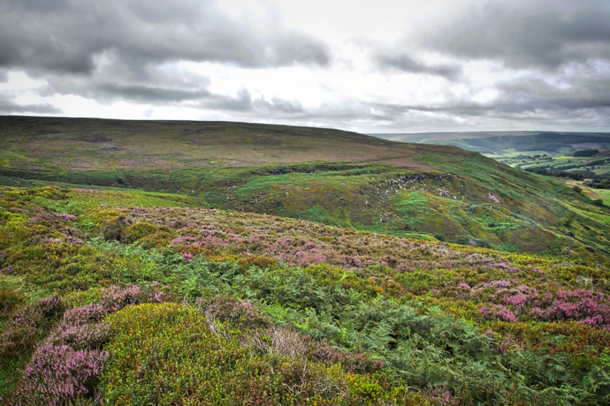
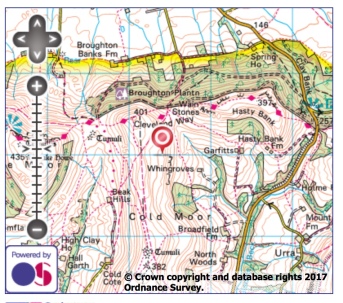
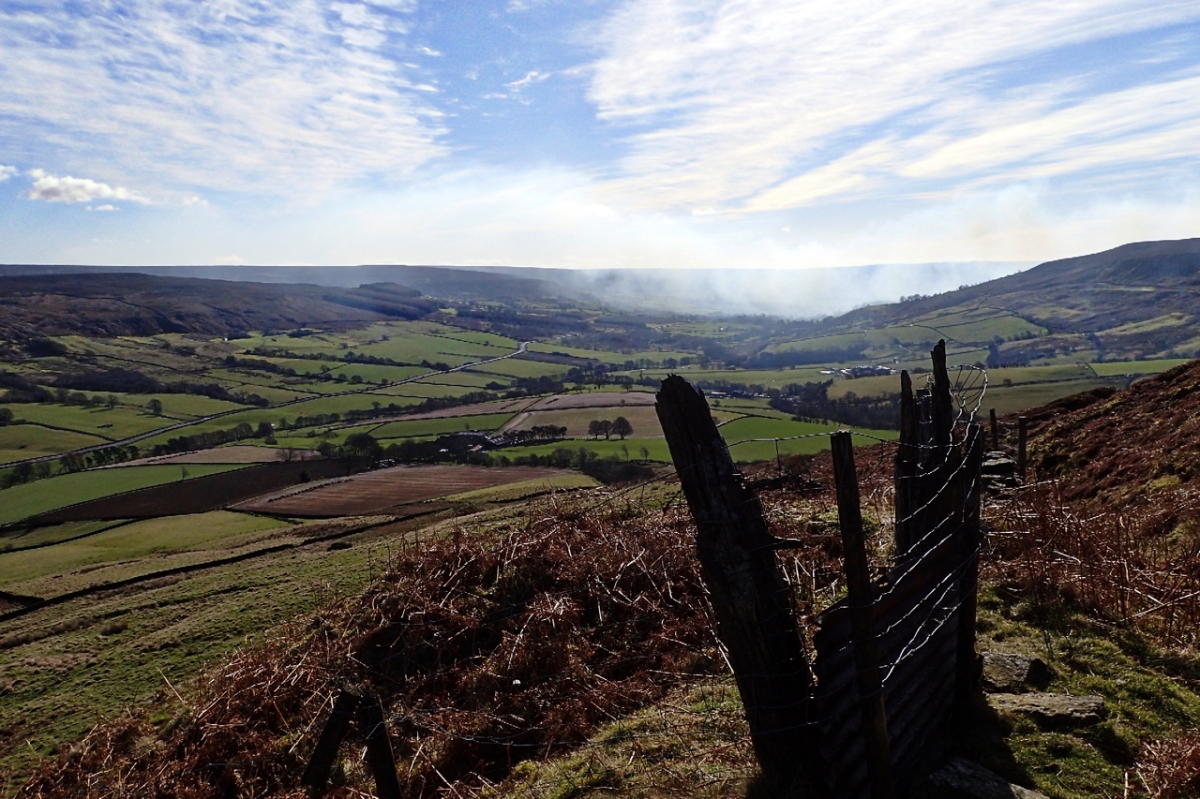
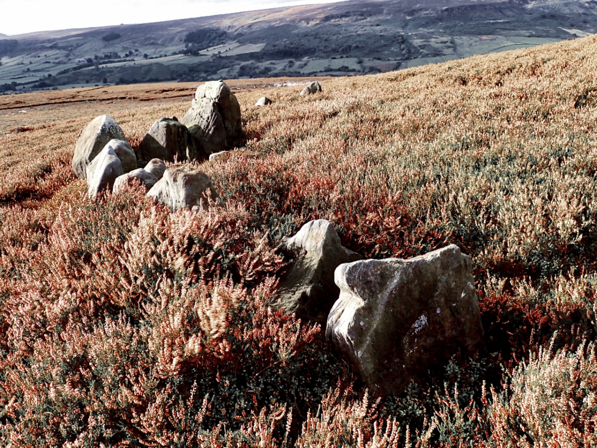
Along the eastern edge of upper Bilsdale is a linear prehistoric dyke almost four and a half kilometres long. In the photo the can be made out on the left curving down to Bilsdale Beck as a bilberry topped embankment with a ditch on the down slope filled with bracken. From the beck the dyke rises then contours around the escarpment. The embankment is up to 3.5m wide in places and typically half a metre high. It is faced with stone in places. The ditch is a maximum 3m wide, half a metre deep and in places cut into the sandstone bedrock.

Similar dykes on the North York Moors are considered to be Middle Bronze Age which dates it to 1500–1200 BC. Other local names for the Urra Moor dyke are Billy’s Dyke, Cliff Dyke and Cromwell’s Lines. The former I guess a reference to the often repeated legend that William the Conqueror lost his way on the approaches to Bilsdale in his harrying of the North thus giving rise to the dale’s name although a more likely explanation is that Bilsdale derives from the old Norse name Bildr.

For what purpose the dyke was built for no one is sure. Defence? Stock enclosure? Prestige? Its construction must have taken a lot of resources so it would certainly have marked an important boundary. Perhaps a warning to those about to enter a tribe’s territory.

Urra Moor dyke map

Barn, Weighill’s Plantation

This barn has always intrigued me. So big it’s almost out of context. Above Bilsdale Hall. The pines beyond are the last remnants of Weighill’s Plantation probably named after John Weighill who, in the 1901 census was living in Bilsdale Hall, aged 61. And in the distance is Garfit Gap, the col between Hasty Bank and Cold Moor.

Barn, Weighills Plantation map

Clough

Just a tumble of moss covered sandstone rocks at the junction where a footpath off Bilsdale Moor West meets the footpath from Staindale to Raisdale Mill. It’s easy to forget that Clough was once a working farm, a family home. A family history on the internet tells us that a Sarah Bell was born here in 1816 and was still living here at the time of her marriage, 23 years later. This view must have been so familiar to her and can’t have changed much. Clough is an Old English word meaning a steep valley or ravine, nearby Clough Gill is flowing off the moor. Gill also means a ravine, this time the derivation comes from Old Norse. So Clough Gill is a bit of a double dip name.

Bilsdale from Cold Moor

There is a scene from the movie ‘Shrek’ that I think of every time I come across a boulder where Donkey says to Shrek “I like that boulder. That is a nice boulder.” And I do like this boulder, it adds a point of interest in the drab browns of the winter moorland.

I am on Cold Moor and looking east across Bilsdale to Urra Moor, the highest point on the North York Moors at 454m asl. Half way up the slope on the far above the green pasture fields lies the hamlet of Urra while down in the dale a tree lined River Seph flows towards Helmsley. Urra is said to be derived from the Old English word horh meaning filth. Perhaps  there is some true in the local legend that William the Conqueror did indeed utter profanities after getting navigationally challenged in the valley.

Bilsdale from Cold Moor map

Bilsdale

From Trennet, above Chop Gate. A tranquil scene with glorious blue skies marred by the smoke of heather burning on Bilsdale West Moor. Heather burning is a practice carried out for the sole purpose of increasing the density of Red Grouse breeding on the peat moors. In its wake it carries the risk of complete incineration of whole ecosystems of invertebrates and small mammals, reduces peat formation and water and carbon storage and increases rain run off and dissolved organic carbon in streams and rivers. Of course there are regulations to control burning. The “season” is from 1 November to 31 March for one thing and the smoke should not be likely to damage health or cause a nuisance for another but the amount of burning of our moorlands has increased. The Committee on Climate Change found that:

“The area of burned moorland has increased significantly in recent decades across much of northern England. A comparison of aerial photography from the 1970s and 2000 of over 200 km2 of the English uplands found that the extent of new burns had doubled (from 15% to 30%) over this period. A recent study found that the annual number of burns between 2001 and 2011 increased by 11% per year, with an accelerating trend in more recent years.

And all so the maximum number of Red Grouse can be killed which we, as taxpayers, are probably subsidising to the tune of £56 per hectare per year as an agricultural subsidy.

Bilsdale map

Bilsdale

Bilsdale, the most westerly of the steep sided North/South dales of the North York Moors. Seen here from The Wainstones in the early morning sunshine.

There is a local legend that the name Bilsdale comes from William the Conqueror, who is said to gotten himself lost in the dale during his harrying of the North. So fed up was he that once he escaped from the valley he left it unscarred and never bothered to return. But on the other hand the etymologists say that the name is derived from the old Norse personal name “Bildr”. So you take your pick.

In the distance on Bilsdale West Moor is the 314 metres high Bilsdale Mast constructed in 1969 by the BBC to transmit the latest technology, colour TV , to Teesside. With its red aircraft warning light it provides a well known landmark at night. Assuming of course there is no mist and it can be seen.

Bridestones

A climb up to Nab Ridge between Bilsdale and Tripsdale. Ended up trying to wade though a thistled rough pasture whilst following a diverted path around the manicured lawns of Cam House. And the pet llamas took a dislike to the dog.

I was aiming for the Bride Stones, a Bronze Age round barrow, long since gone with only the kerb stones remaining. A circle could clearly be seen, about ten metres in diameter, although many stones are now buried by the heather.

There are other Bride Stones on the moors and beyond throughout Northern England. Some say the name comes from Bride, the Mother Goddess of the Brigantes, a Celtic tribe inhabiting the modern counties of Yorkshire, Lancashire, Northumberland and Durham. Other placenames having the same etymology are Bridlington, Brigham and Brigg. An alternative theory is that the name originates from the Old English word for a young bird or chicken: “bridd”.

Seave Green

Blue skies, an inquisitive bullock and the sandstone cottages of Seave Green, an hamlet in upper Bilsdale, make an idyllic scene. A scene which, if the Victorian speculators had had their way would have looked quite different. In 1874 a railway was proposed running down the valley through the fields on the far side of the beck. The railway was to run from Ingleby Greenhow to Helmsley through two tunnels under Clay Bank and Newgate Bank. Fortunately by this time investors had become more cautious following the railway mania bubble of the 1840s. Of course if the plan had gone ahead it is most likely the line would have been axed by Beeching in the 1960s.

Urra Moor

A drab misty start to the week with rain threatening. The boundary stones across Urra Moor probably mark the limit of the Feversham estate. Bilsdale below is only just visible.

Swaledale sheep, Bilsdale

At least I think these are Black Faced sheep, one of the traditional breeds of the Northern hills. Other contenders could be Swaledales and Rough Fells. Quite frankly after looking at scores of photos on Google they all begin to look the same. All three are found on the North York Moors and all are said to be descended from a small flock that was on board a fleeing Spanish vessel of the Armada that was shipwrecked off the Cumberland coast. Which begs the question as to what breed of sheep were the medieval monks of Rievaulx Abbey farming.

One local name for Black Faced sheep is Moorjocks which is also used as a derogatory name for dales folk.

On some grouse moors sheep are used as tick mops to control ticks which weaken young grouse chicks. The sheep would be dipped up to 5 times per year to kill off the ticks and then released again to collect more ticks.


These sheep hiding behind a dry stone wall are on Carr Ridge overlooking Bilsdale.