Raisdale

Back from two weeks in the Outer Hebrides and already planning next year’s trip but as John Denver sang “hey, it’s good to be back home again”. This is the eastern branch of Raisdale with Beak Hills farm below the narrow ridge of Cold Moor or, as it was once called, Mount Vittoria.

Raisdale map

Gate post, High Crossletts

In Raisdale above High Crossletts farm, a traditional gate post or stoop or to use the North Yorkshire name yat stead. There is no trace of the other stoop which would have been located about where I was standing to take the photo. It would have had recessed holes corresponding to the grooves on this one. One end of poles just a bit wider that the gap would been inserted into the holes and the other end slipped along the groove, closing the gap.

The other post in the photo is a relatively modern pre-cast concrete one. All traces of the field boundaries have disappeared and these two posts stand in isolation. Looking at the 1857 Ordnance Survey map a lane enclosed both sides is shown on the alignment on the gate, perhaps evidenced today by the presence of nettles indicating a nitrogen rich soil. But by 1915 this lane is shown with a boundary one side only, the existing wall you can see today.

High Crossletts map

Mill Lane, Raisdale

I remember running down this track in the 1990s. It was then a B.O.A.T., a Byway Open to All Traffic. You could take your car down it if you wanted, and many did. Landrovers anyway. On this day a convoy of Landrovers were trying to get up the hill. Ropes were tied to trees and the winches on the Landies, a de rigueur accessory, were in full use. One vehicle was on its side. All jolly good fun but not so good for this ancient route from Scugdale into Bilsdale. Recently, after much protest by the off road enthusiast community, the track has been downgraded to Public Bridleway status. All motorised vehicles are prohibited, although the Ordnance Survey map still shows it as a by way. I came up the track today and, in spite of signage showing the new status, saw plenty of evidence of recent motorcycle usage. It seems the prohibition is being ignored.

Mill Lane map

Clough

Just a tumble of moss covered sandstone rocks at the junction where a footpath off Bilsdale Moor West meets the footpath from Staindale to Raisdale Mill. It’s easy to forget that Clough was once a working farm, a family home. A family history on the internet tells us that a Sarah Bell was born here in 1816 and was still living here at the time of her marriage, 23 years later. This view must have been so familiar to her and can’t have changed much. Clough is an Old English word meaning a steep valley or ravine, nearby Clough Gill is flowing off the moor. Gill also means a ravine, this time the derivation comes from Old Norse. So Clough Gill is a bit of a double dip name.

Upper Raisdale

Or is it? There is no doubt that Raisdale is the name of the valley extending north west from Chop Gate in Bilsdale. The Ordnance Survey map names it as such. But when the valley splits at Raisdale Mill it becomes more equivocal. The map shows the name Raisdale as extending up this short right hand fork to a remote farm called Beak Hills otherwise the beck along its bottom is unnamed. Raisdale Beck though is shown as flowing down from the left hand valley. Between the two forks rises the bulky Cringle Moor to 432m above sea level.

Today the gulley leading down to the farm from the ridge of Cold Moor has the legal status of a Public Bridleway but is evidence of an old track of extensive usage. I don’t suppose it is correct to call it a holloway, from the Anglo-Saxon “hola weg” meaning a sunken road. In Danelaw it would no doubt have had a Norse name. The gulley is fairly typical of tracks leading off the high moors, a diagonal descent easing the gradient.  Sometimes there are several gullies in parallel. Even into the 20th century the practice was to use sleds to transport bales of heather and peat blocks down off the moors. Heather or ling was used for thatching and bedding and peat was a valuable fuel. Sleds would also have been the method of transporting the sandstone from the outcrops for building the farms, barns and walls. Years of such sledding would have created the gullies. I imagine once a gulley became too eroded, control of a heavily loaded sled would of become very difficult even dangerous and so a new route off to one side would be sought.

Raisdale

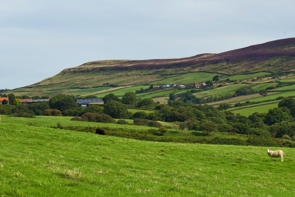
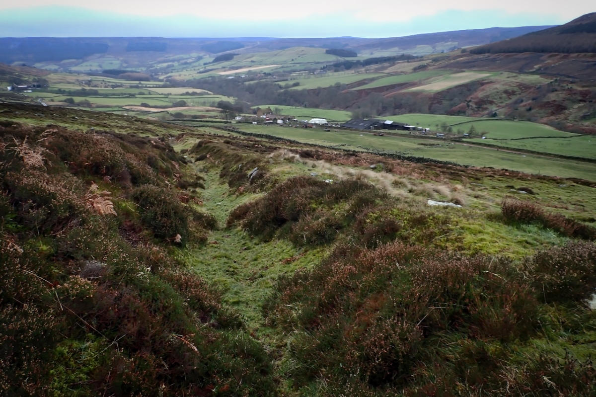
In its upper reaches Bilsdale splits into two separated by the mass of Cold Moor. The western arm is Raisdale. This photo is taken from a small prominence called Wath Hill and is looking up the valley towards the Lord Stones Cafe.

To the left is the farm, Staindale. And to the right another farm Broomflatt. In John Marius Wilson’s Imperial Gazetteer of England and Wales, 1870-72, Raisdale is described as a constablewick which is an obsolete word meaning the district over which a constable exercises his duties and power. A constable is not the modern police constable but an official who initially was responsible for collecting the taxes due to the Lord of the Manor on behalf of the King.

Over time the office of Constable would gain various other duties such as dealing with felonies, vagabonds, beggars, and itinerant strangers. The list goes on and on: lewd women, pauper children, the “defaulting fathers of bastards”, welfare of the poor, the parish bull, non-attendance at church, keeping militia rolls, etc., etc.