
Harvesting at Aireyholme Farm. Wheat I think. The skyline is the escarpment to Great Ayton with Gribdale Gate to the right.

Harvesting at Aireyholme Farm. Wheat I think. The skyline is the escarpment to Great Ayton with Gribdale Gate to the right.
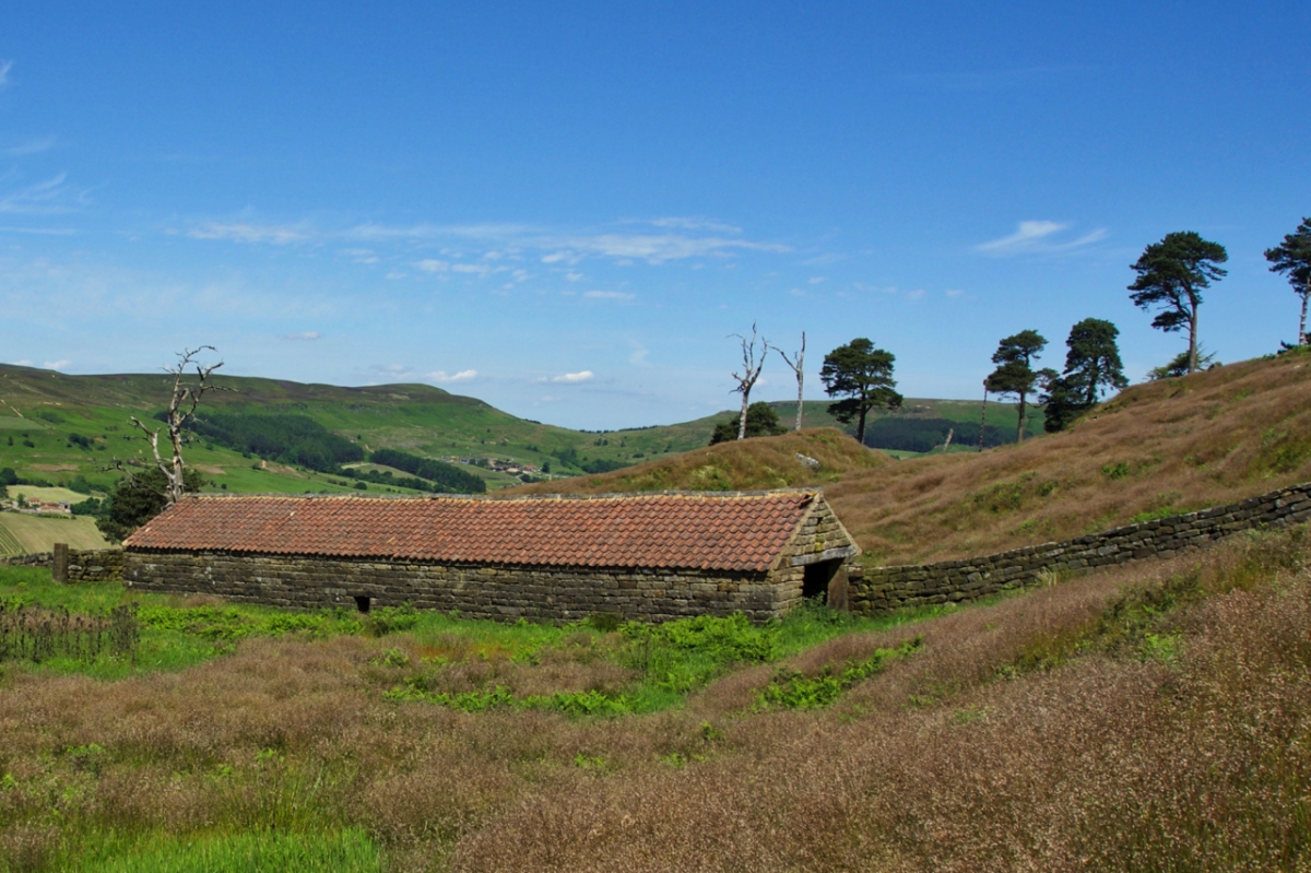
This barn has always intrigued me. So big it’s almost out of context. Above Bilsdale Hall. The pines beyond are the last remnants of Weighill’s Plantation probably named after John Weighill who, in the 1901 census was living in Bilsdale Hall, aged 61. And in the distance is Garfit Gap, the col between Hasty Bank and Cold Moor.

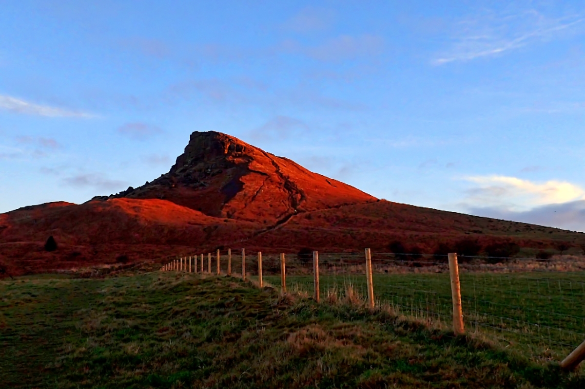
Cleveland’s Matterhorn looking splendid in the first rays of a winter sun. Its sandstone cap, laid down in a river delta 168 to 176 million years ago and subjected to enormous pressures, lies on top of soft, easily eroded shales of what the geologists refer to as the Whitby Mudstone Formation and corresponding to the slopes of dead bracken. Between the two strata lies the thin Roseberry Plant Bed containing fossils of Jurassic tree ferns; one of the reasons why Roseberry has been designated a SSSI. Lower down the slope, the grass pasture grows on the older Cleveland Ironstone Formation.
Blue skies and the odd remaining patch of yesterday’s snow. A cairn on a Bronze Age tumulus on a drab looking moor.
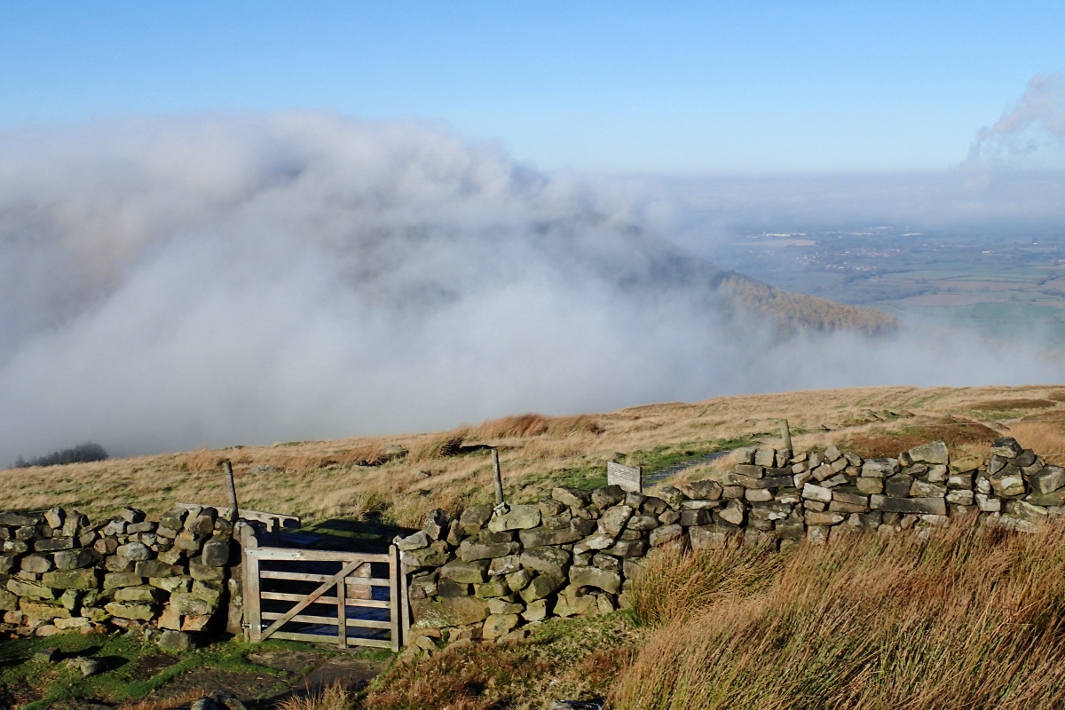
Apparently the whole country has lain under a blanket of cloud today; according to the BBC News. But here in the North East there was a blue sky. This is from the nose of Carr Ridge looking down onto Clay Bank or Hagg’s Gate as it used to be called.


You must be logged in to post a comment.